UAV As-Builts
A scale-accurate solution to installation documentation using 2D sheets and 3D point cloud models. Stop with the guesswork and start tracking circuits, avoiding obstacles, and alleviating headaches.
Installation documentation is a critical part of any project. However, the construction industry’s traditional practices need to be updated. We combine survey, design, and drone technologies to accurately map construction sites for precise installation documentation, enabling us to do the job more effectively than the industry standard. Contact us today to learn how we can help with your next project!


The standard process of documenting installation on projects is quickly becoming outdated. Drawings that are created using pen and paper are difficult to follow throughout the lifespan of a construction project. Using a PDF editor or involving BIM is a step in the right direction, but there is still plenty of room for improvement.
Once the concrete has been poured or dirt has been backfilled, contracting teams should have the option to look back in time and see how their work was completed clearly and accurately.
Our process of utilizing small, unmanned drones to generate scale-accurate maps is a serious benefit to contracting teams. We layer civil, architectural, electrical, and structural plans onto our maps in order to keep our drawings clean and easy to understand. We can include conduit sizes, circuit information, and any other additional details specific to your project.
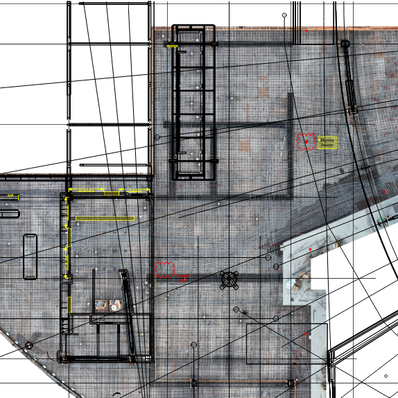
Set the scale on our PDF drawings and pull dimensions from columns, walls, or gridlines. Track conduit and material usage, add your own layers and visibility functions or provide our team with the information you want to be included.
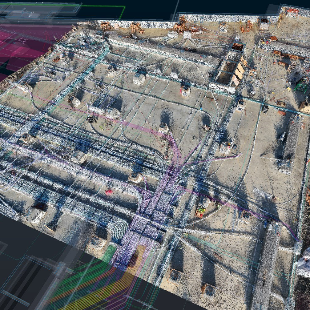
We will tie our 3D Point Cloud Model onto your BIM coordination or revit model. Our point cloud files allow the user to have a 3-dimensional x-ray file long after the project's completion.
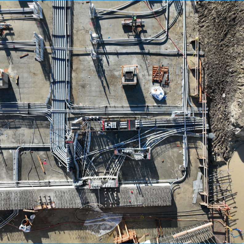
Our HD Photo Sensors allow our clients to zoom-in and identify damaged conduits and accurate site conditions.
© Accutech Field Solutions 2024 | Privacy Policy | Terms of Service | Made with & by IDG Advertising