Drone Mapping

Project Documentation Or Site Inspection? Let Us Handle It!

Drone Mapping

We understand how important accurate site documentation is for any project. Our drone mapping services ensure that every detail of your project is carefully captured, providing your team with the most accurate model possible. This ensures important project data is easily accessible for reference during site inspections and beyond.

Accurate Maps, Faster Results – Mapping the Future of Construction

  • Increased Safety

    Drones can capture aerial data from a safe distance, reducing the need for personnel to work in hazardous environments or at dangerous heights.

  • Cost Savings

    Using a drone to map a project is cost-effective, which gives contracting teams access to accurate data without breaking the bank.

  • Improved Accuracy

    Aerial imagery captured by our drones is incredibly precise, allowing for accurate 3D models that can be used as a reference throughout the entire project lifecycle.

  • Faster Turnaround Times

    By utilizing our drone technology, projects can be completed faster without sacrificing quality since less time is spent collecting data manually on-site and more time is spent analyzing it in the office.

  • Enhanced Data Collection

    Drones can capture a wide range of digital information, including high-resolution imagery and lidar scans, which can be used to create comprehensive 3D models for construction projects.

Benefits of Drone Mapping

Having accurate measurements for your construction project is imperative for any site inspection, as well as ongoing building maintenance. Our drone mapping service allows for you to have the most accurate project site data possible through the use of drone mapping combined into a 3D model, providing you with an accurate rendering of your job site.

Capturing the World in 3D

What We Provide

A

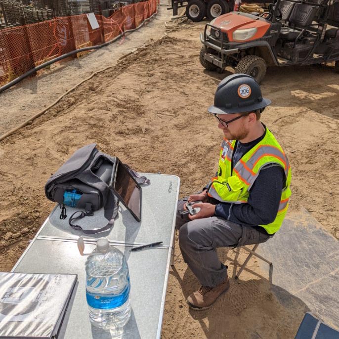
Drone mapping requires the site to be surveyed in order to plan a flight path. Our goal is to always capture an accurate representation of existing site conditions so that our models can be used for topographic analysis, feature extractions, and other applications.

Preflight Preparation

B

We use discreet quadcopter drones to collect high-resolution images from different angles at various altitudes. The drone operator uses a combination of aerial image capture, depth and distance calibrations, and GIS data to map the area of interest for further analysis.

Data Collection

C

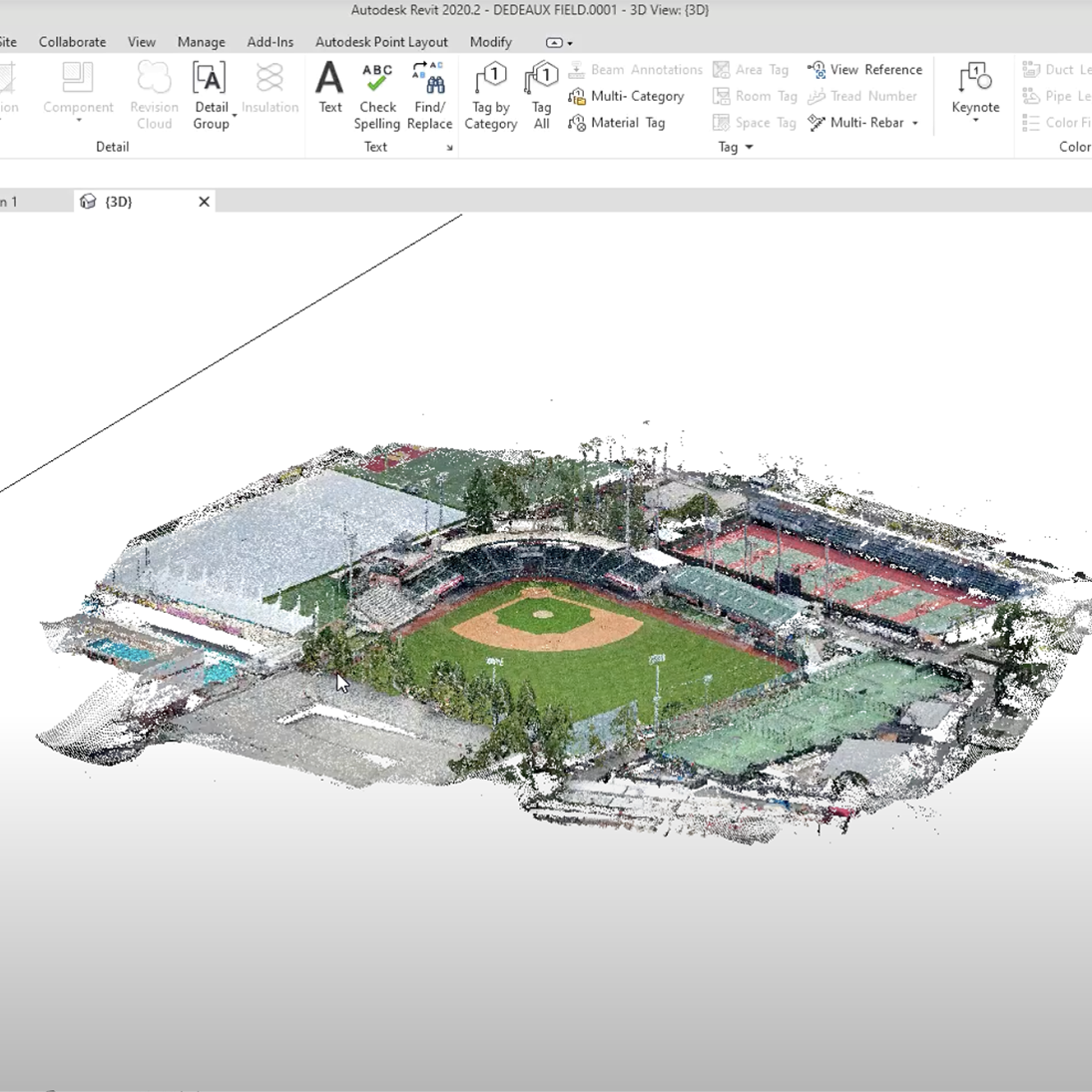
Using specialized software, the images captured by the drone are coupled with GIS data and depth information from the drone's sensors. This information is then turned into a 3D model which can be analyzed using photogrammetric techniques such as point cloud generation and surface modeling.

Model Creation

Check Out Some of Our Other Services